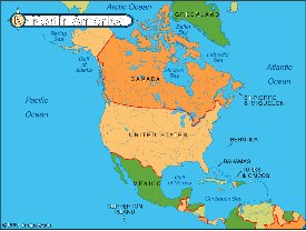
| 1. Political – shows divisions and boundaries by colors
|
|
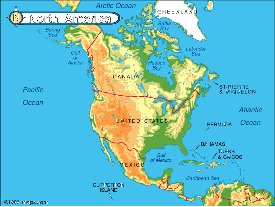
| 2. Physical – shows elevation, rivers, lakes, … by color
|
|
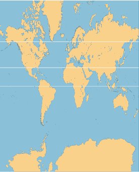
| 3. Mercator – meridians & latitudes appear as lines crossing at right
angles. Shows round earth on flat
paper.
|
|
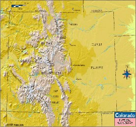
| 4. Relief map –a map a raised & lowered surfaces like mountains and valleys
|
|
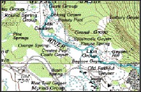
| 5. Topographical – surface features, manmade or natural
|
|
| 6. Interrupted – the oceans are interrupted to keep distortion of land to a minimum
|

|
7.  Grid –horizontal and perpendicular lines for locating a point on a map
|

|