Name_________________________
Partner(s)______________________
Lab: Reading Contour Maps Date________, Block ___________
Contour Maps are used to convey a huge amount of information about a particular section of land, called a quadrangle. There is information on terrain, vegetation, roads, other human-made structures, and other scientific information. These maps have a great many uses for a large number of people in many different areas.
It is necessary to read and recognize how a contour map is organized. You need to read the material found at the bottom of the map to understand the information the map shows. These maps use many symbols to convey other information and you will need to use your textbook to translate much of these symbols.
In this work we will be using ;contour maps showing the "Wolcott" "Rose" and "Savannah" quadrangles since so many of us live in one of these quadrangles. Read ALL THE INSTRUCTIONS CAREFULLY!!!!! and answer the questions (based on the maps) found below.
For part of this work, you will need to refer to page 666 of your textbook to determine what some of the symbols used on these maps mean.
Part 1: General Questions
1) List the scale found on these maps. ___________________________
2) What is the contour interval found on these maps?_______________
3) List the latitude and longitude (with both the degree and estimated
nearest minute) for each of these locations:
a) the center of the village of Wolcott______________________
b) the center of the village of North Rose___________________
c) the center of the village of Savannah ____________________
4) Note the year that the maps were printed _______________________
Part 2: Savannah Quadrangle questions.
1)What is the landscape/terrain in the SW quadrant of this map? How is this shown on the map? ________________________________________________________________
2) What is the most common type of vegetative feature found on this map? ________________________________________________________________________
3) What two counties are represented on this map? ________________________
4) What is the highest elevation found on this map? _________What is the symbol found
at this elevation? __________
5) How long is the Old Erie Canal shown on this map? _______________ What would be the best technique to measure this? _________________________________________
6) Find Shepherd’s corner in the north west corner. If you traveled .35 miles slightly west of due south from the intersection at Shepherd's corner,
a) What topographic feature is present? ________________________________________
b) State the change in “field value” from Shepherd’s corner to the highest elevation of this feature.
Elevation at Shepherd’s corner = ___________, highest elevation of feature = ______
Change in field value is ____________________ (units?)
c) Measure distance from highest to lowest point __________________________miles
d) Calculate gradient
1) write down equation
2) substitute numbers
3) calculate answer with units
7. Look closely at the Montezuma Marsh area.
a) What observation can you make about elevation in a swamp? ____________________
________________________________________________________________________
b) Note Crusoe Lake in the NE section of the map. There are three streams leading to the edge of Crusoe Lake, Butler Creek, Crusoe Creek and an unnamed creek. Identify whether these water passages are entering or leaving the lake. What evidence did you use to determine this?
unnamed creek __________________________________________________________
Butler Creek _____________________________________________________________
Crusoe Creek ____________________________________________________________
c) Look at Black Creek, using your observation skills, predict which direction the water moves, what evidence did you use?
Part 3: Wolcott Quadrangle questions.
1) What is the straight line distance, in kilometers, from Rice Mill (NW corner of map) to Stewart Corner?(W of map center)__________________________________________
2) Read the following carefully: In what direction would you travel to go to Lovejoy Cemetery (just W of center)on Salter Colvin Road from Sprague Cemetery (E of map center on Van Blake Road)?________________________________________________
3) What is the elevation of the highest point on this map? __________
4) What symbol is missing from the north side of Salter-ColvinRoad, across from the gravel pit/quarry? _________________________________________________________
5) What human-made feature exists at 43
�
14’ N, 76º 46’ W?
_________________________________________________________
6) Find Crane Road on the map( just N of the word BUTLER).
a) Why was Crane Road built in this particular path? __________________________
_____________________________________________________________________
7) There is a small creek below the letters "WOL" of the large "WOLCOTT" in the NE quadrant of this map.
a) In what direction does this creek flow? ______________________
b) What evidence do you use to determine this? _______________________________
8) Locate the word BUTLER near the eastern side of the map. Between the T and the L there is a contour ring with hatch marks.
a) What does this symbol represent? ________________________________________
b) What other feature is located there to support this concept? ______________________
9) Find the village of Wolcott. Note the contour lines running north from the pond.
a) Describe the landscape. _________________________________________________
b) What evidence did you use to support this? __________________________________
c) In which direction is the creek flowing? _____________________________________
d) Furnace Road crosses the contour lines, what can you infer from the map about the
design of the road at this point? _____________________________________________
Part 4: Rose Quadrangle questions.
1) What is the deepest depth of Sawmill Cove? ___________________
2) What is the mean elevation of Lake Ontario? __________________
3) There are several creeks entering the southern most section of Sodus Bay.
a) Describe the topography that you would expect to see surrounding each of these inflowing creeks.
________________________________________________________________________
________________________________________________________________________
________________________________________________________________________
4) Locate Limekiln Road on the western edge of the map. Calculate gradient of the hill from the peak to the most southern contour of the southern edge of the hill.
a) Write the equation for gradient
b) Substitute values into equation.
c) calculate answer, include proper units.
5) What is the elevation of the Landing Strip NW of the North Rose Elementary School?__________________
5) What is the elevation of South Sodus? ________________________
6) What is the elevation of the lowest point on ;this map? ___________
7) In what direction does Second Creek flow, located near South Sodus flow? _____________
8) Locate Black Creek. South east of South Sodus.
a) In which direction does it flow?_______________________________________
b) Propose a reason why Second Creek flow one way and Black flows a different way.
________________________________________________________________________
**Continue to the next page**
8) Just south of Lime Kiln Road on the western edge of the map is a dashed line about 6 inches long. Draw a profile showing the changes in elevation you would make as you traveled along this line.
a) Using the edge of a piece of paper carefully mark each contour line. On the paper record the elevation of each bold contour line you marked. Also label W for west a E for east on the line.
b) On the grid below, transfer each mark and labeled elevation onto the X axis.
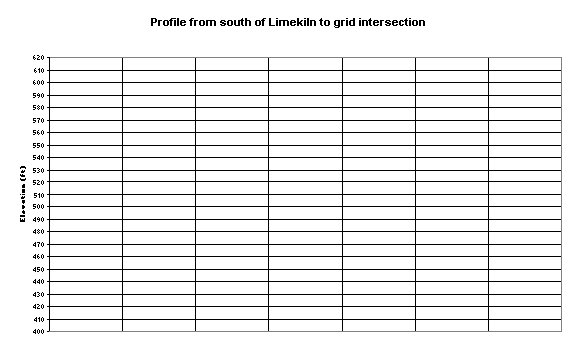
c) Plot points. Connect the points with a smooth, curving line.
e) Label the following: W, E, Route 14, 3 swamps.
Back to top